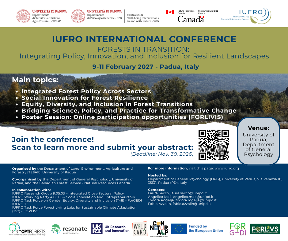
Bringing together researchers, policymakers, practitioners and other forest stakeholders, the conference will explore how better policy integration, social innovation and inclusive governance can help address the complex social, ecological and economic changes shaping our forests.
Expect fresh perspectives, inspiring discussions and opportunities to exchange ideas across disciplines and sectors. An online poster session will also offer the opportunity to contribute and connect remotely.
Do you have relevant research or experiences to share?
Organised by the University of Padua’s Department of Land, Environment, Agriculture and Forestry (TESAF), together with the Department of General Psychology (DPG) and Natural Resources Canada – Canadian Forest Service.
Let’s bring different perspectives together and help shape the future of our forest landscapes!
Today, on the International Day of Women and Girls in Science, the we celebrate the contributions of female researchers who are advancing knowledge and innovation in rewilding and ecosystem restoration across Europe.
Sara Cazzaniga, a Postdoctoral Researcher at ETH Zurich, studies the invisible yet powerful world beneath our feet: soil microbes. While rewilding often focuses on visible changes in landscapes and wildlife, Sara’s work uncovers how bacterial and fungal communities drive ecosystem recovery from the ground up. By linking below-ground microbial processes to above-ground ecological outcomes, her research helps ensure that soil biodiversity is recognized in policy and restoration strategies, providing essential evidence for informed decision-making.
Lena Lopez, a PhD researcher at the Technical University of Munich, is driven by the potential of science to catalyse coexistence between humanity and nature. As part of WILDCARD, she models land allocation scenarios for rewilding and proforestation across the European Union. Her work explores how different land-use pathways can support biodiversity while considering social and economic dimensions, contributing valuable insights for policymakers and landowners.
Lucia Seebach, a researcher at the Forestry Research Institute of Baden-Württemberg, Germany, brings a lifelong passion for environmental protection and geoecology to WILDCARD. Inspired by experiences in wild landscapes and national parks, she focuses on forests with the potential to become wild again. By accompanying natural forest development and studying ecosystem processes, Lucia’s research highlights the resilience of nature and the importance of giving ecosystems time and space to recover.
Together, Sara, Lena, and Lucia exemplify the interdisciplinary and forward-looking science at the heart of WILDCARD. Their work not only advances understanding of rewilding but also provides evidence to support sustainable land-use policies and biodiversity conservation. On this day, we proudly recognize their contributions and encourages the next generation of women and girls to pursue careers in science and environmental research.
Across Europe, landscapes are quietly changing. Mountain farms and pastures are being abandoned, forest management is easing in some regions, and climate and policy pressures are reshaping how land is used. For some, these trends raise concerns. For others, they open a powerful question: where could nature return, at scale, if we let it?
Rather than asking where rewilding should happen, this work asks a more grounded question: where is rewilding most likely to happen, given social, economic, and environmental change? The answer provides a much-needed baseline for understanding Europe’s rewilding potential – and for shaping future policy and restoration strategies.
Seeing opportunity in land-use change
Rewilding in WILDCARD is not a single process. It emerges through different pathways: when agricultural land is abandoned and forests naturally grow back; when managed forests are allowed to mature and develop more natural structures (proforestation); or a large step towards rewilding can be taken by going from intensive agricultural use to new mixed-use forests where ecological needs are explicitly addressed.
First main pathway to wilder forests in Europe: Agricultural abandonment can trigger rewilding from croplands/grasslands/mosaics toward more natural forest states, either by shifting into a combined-objective forest (some continued management alongside recovery) or by moving into close-to-nature forest through more hands-off rewilding.Second main pathway to wilder forests in Europe: Proforestation, instead, focuses on existing forests, reducing management so plantations or multi-use stands mature into close-to-nature forests.
To capture this complexity, researchers explored eight future scenarios that reflect different development pathways for Europe. These scenarios cover both the IPCC Shared Socioeconomic Pathways and the IPBES Nature Futures Framework, ranging from business-as-usual futures to more ambitious, policy-driven nature restoration pathways. More particularly, the IPCC Shared Socioeconomic Pathwaysdescribe different ways society, economies, and governance might develop in the future, from current trends to transformative change. The IPBES Nature Futures Framework adds perspectives on how humans value and interact with nature. Together, they offer a comprehensive picture of how Europe’s landscape could evolve, visually showing how different socio-economic choices and visions of nature we prioritise can shape future land-use patterns.
At the heart of the analysis lies the CLUMondo model, a spatially explicit land-use model that simulates how land systems evolve under changing demands, policies, and biophysical conditions. The model projects land-use changes across Europe from 2020 to 2050, at a fine resolution of 1 km², allowing researchers to zoom from continental patterns down to regional detail.
Mapping Europe’s rewilding hotspots
Despite the diversity of futures explored, a striking pattern emerges from the WILDCARD work: forest recovery is an important feature in almost all scenarios.
The strongest signals appear along Europe’s major mountain systems – the Alps, Pyrenees, Carpathians, and the Dinaric–Šar–Pindus arc – where steep terrain, lower agricultural profitability, and existing forest cover create favourable conditions for natural regeneration. These landscapes form the backbone of Europe’s potential rewilding corridors.
Different processes dominate in different regions
Proforestation is most common in areas with relatively large and not very intensively managed forests, where reduced intervention allows forests to develop toward near-natural conditions.
Agricultural abandonment and rewilding are most likely in marginal farmland, particularly in Southern and Central Europe, where retreating agriculture opens space for forest regrowth.
Combined-objective forests emerge on previously cultivated lands mainly in Central and Eastern Europe, where land is released from agriculture but remains partially managed for multiple benefits. While not rewilding per se these transitions make an important contribution to a wilder Europe.
When these processes are combined, they reveal a coherent continental picture: rewilding potential clusters in uplands and less productive landscapes, while Europe’s intensively farmed lowlands largely remain under production.
Graphic: Total rewilding probability map of Europe, representing areas with different levels of agreement across all eight land-use change scenarios. The maximum probability is reached when the conversion from croplands (arable and permanent), grasslands, mosaics and managed forests to close-to-nature forest occurs in all eight scenarios
Why policy matters
One of the most important insights comes from the “SSP2 – Planned Rewilding scenario” developed by WILDCARD researchers. Here, rewilding is not left entirely to chance. Spatially guided towards areas of potentially high ecological importance and good chances on rewilding success, policy-supported measures produce more connected and coherent forest recovery patterns than spontaneous abandonment alone. In other words, how we guide rewilding matters as much as where it happens.
These first maps do not offer final answers – and they are not meant to. Instead, they provide a continental baseline: a shared reference point for exploring trade-offs, biodiversity outcomes, and climate benefits in the next phases of WILDCARD. As future deliverables refine these scenarios and link them to ecological and social outcomes, one message is already clear: Europe’s forests of the future are taking shape now – and understanding where nature can return is the first step toward letting it thrive.
Do you want to discuss with us about how much rewilding is Europe ready to accept? Are you a researcher, policymaker, artist, or practitioner interested in exploring one of Europe’s most pressing environmental questions? If yes, make sure to express your interest and register quickly for the 2nd Rewilding Forum taking place on 24–25 February 2026 in Freising, Germany. Set against the implementation of the EU’s Nature Restoration Law, the forum will examine the role rewilding can play in addressing the twin climate and biodiversity crisis. You can find the programme here!
EU policymakers have acknowledged the scale of this challenge through the landmark Nature Restoration Law, which calls for restoring at least 20% of Europe’s land and sea areas by 2030, with restoration efforts extending across all ecosystems by 2050. As Member States begin to prepare and implement their national restoration plans, the WILDCARD project is generating critical insights into how far nature itself – through passive rewilding and non-intervention – can contribute to achieving these ambitious goals.
Our discussions will explore how people perceive rewilding, examining the social factors that enable or hinder public acceptance and highlighting potential gaps between EU-level ambitions and local perspectives. Participants will also consider how passive rewilding can be integrated into policy as a deliberate strategy to address biodiversity loss and land abandonment, and whether it can help foster more sustainable relationships between communities and nature. A further strand will look at how art and storytelling can shift perceptions, open up new ways of thinking, and reshape the public debate around rewilding.
On the second day, we will visit the Walddynamik experimental site to see the WILDCARD project in action, as well as the Freising Climate Forest. These field visits will offer a firsthand look at how research, practice, and art intersect on the ground.
Register your interest to join the 2nd Rewilding Forum here.
WILDCARD can cover participation costs if needed.
Detailed travel and accommodation information will be provided after registration.
Featured image: Stakeholder Engagement activities in the forest, Germany (photo: Gesche Schifferdecker)
Soil might not be the first thing you notice when walking through a nearby forest. But it’s a quiet, hidden guardian that our forests depend on. It connects trees, insects, and fungi in ways we often overlook. Many soil organisms feed on dead plant residues, making important nutrients available to plants. Additionally, while feeding and digging, they incorporate organic carbon into the soil, improving soil structure and water holding capacity. Healthy, biodiverse soil is therefore essential for making forests resilient and multifunctional and cannot be ignored by anyone working in sustainable forest management.
When I walk through a forest, I am always struck by the sense that there is more happening than I can perceive. My eyes trace the trunks of trees, the canopy stretching above me, and the shafts of light breaking through in places. But I also know that much of the forest remains hidden from my view. Forests are not some layers of vegetation; they are complex, three-dimensional worlds. They grow upward, outward, and in intricate layers, creating habitats within habitats. To truly understand how these structures form and evolve, we need tools that go beyond what our senses and traditional methods can capture. That is where LiDAR comes in, and why it has become such a powerful part of our work in the WILDCARD project.
LiDAR – Light Detection and Ranging – allows us to map forests in three dimensions at centimetre-to-metre resolution. By sending out laser pulses and measuring how they reflect, LiDAR creates an extraordinarily detailed picture of vegetation structure. From airplanes, it can cover entire landscapes, but in WILDCARD we focus mainly on ground-based and drone-mounted systems. These cover smaller areas, yet their precision is remarkable, revealing the layers of the understory, the openings in the canopy where light filters through, the presence of exceptionally large trees, and the way these elements combine into complex arrangements across a site. What excites me most is how LiDAR connects many different domains: a single dataset links the technical world of remote sensing with ecological research and the very practical sphere of management and policy. It shows us what remains invisible to aerial photographs and ground surveys – the fine-grained complexity of the understory, the architecture of the canopy, and the shifting patterns of light and space that drive ecological processes. And what truly matters is not just capturing these patterns but translating them into indicators that reflect biodiversity, turning three-dimensional point clouds (the reflections of laser beams emitted by the scanners) into ecological meaning.
Drone pilot Bára Kobosilová ready for the start at Jansheideberg site, Belgium. Picture: Dan Cigánek
For rewilding, this information is crucial. Rewilding is not just about leaving land unmanaged and hoping for the best. It is also about letting natural processes unfold and observing how they gradually create new ecological opportunities. LiDAR allows us to measure these changes. By comparing sites of different ages and management histories – what we call a space-for-time substitution or chronosequence – we can track how complexity develops once human interventions stop. Over decades, forests shift in structure, forming vertical layers, creating gaps, and offering niches for species that depend on a dynamic habitat. These transformations are difficult to capture with traditional field plots, which often rely on sampling a small number of trees or features. LiDAR, on the other hand, gives us a comprehensive picture and a repeatable way to observe these changes across dozens or even hundreds of sites.
With LiDAR, we can start to ask why forests behave the way they do. Why do carbon accumulation and biodiversity often rise together in some places, while in others the two seem to diverge? How does structure influence species composition? And how might we use this knowledge to guide rewilding in ways that support both climate goals and biodiversity? These are questions that matter deeply, not only to scientists but to policymakers, land managers, and communities who want to see landscapes recover.
Pictures: Bára Kobosilová and Dan Ciganek
From our pilot sites we already have encouraging results. We have built a robust processing pipeline and developed a first set of structural indicators. The early patterns are striking: rewilded stands seem to show higher levels of both vertical and horizontal complexity than managed stands. These structural differences are precisely the kinds of features that many species depend on, and we anticipate strong correlations with independent measures of biodiversity. At the same time, we are grappling with real challenges. Data collected from different sensors and platforms do not always align neatly, and we need to harmonise them to ensure comparability. We are also learning about the limits of scale – how small a plot can be before its complexity becomes too difficult to measure reliably. These are technical hurdles, but they are also stepping stones that will allow us to expand our analysis across the entire WILDCARD network.
For me, the most exciting aspect of this work is its potential to shift how we think about rewilding. Forests are often described as carbon sinks or as habitats for species, but the WILDCARD project reveals them as both at once: living, evolving, complex three-dimensional systems. With the LiDAR technology we can not only see but also measure the richness of their structure and begin to understand how it shapes biodiversity and carbon dynamics together. That knowledge can inform rewilding strategies, guide conservation investments, and support policies that build resilient ecosystems. Forests are more than collections of trees. They are dynamic, intricate habitats that we are only beginning to understand in full. LiDAR gives us a way to step into that complexity, to capture it with unprecedented precision, and to tell the story of rewilding in three dimensions. For WILDCARD, it means we are one step closer to making the so far hidden patterns measurable, and to building the knowledge that will help rewilding succeed at scales that truly matter.
In the quiet forests of Northeastern Romania, near the town of Suceava, a remarkable rewilding story is unfolding.
This short film takes us into the heart of Vânători Neamț Nature Park, where the European bison, once extinct in the wild, is once again roaming free. The journey began in the 1970s, when the first bison were brought to Romania by the National Forest Administration. But it wasn’t until 2003, with support from a World Bank project, that the dream of rewilding took real shape, with infrastructure built and the first animals arriving in the park.
By 2012, the first five bison were released into the wild. Since then, more have followed, year after year, slowly rebuilding a population that had vanished. But this isn’t just about restoring a species. It’s about restoring balance between open fields and forest, between people and nature.
The European bison is more than a keystone species. It’s a national symbol, deeply woven into Romanian and Moldavian heritage. Its presence now supports local economies, from eco-tourism to traditional crafts, and fulfills important EU conservation goals.
And while the term “rewilding” may be new to some, the idea isn’t. As Laura Bouriaud from the Stefan cel Mare University of Suceava says, “we are living with nature. Even if we didn’t put this name on it, rewilding is part of our life.”
Imagine walking through a primeval forest – towering trees with gnarled branches, thick undergrowth, and chaotic piles of fallen branches and logs. It would also be bursting with life, from the mats of moss and lichens covering logs, to the birdsong echoing across the canopy, or the insects of all sizes buzzing around on a hot day.
Primeval forests like this are a rare sight in today’s Europe. But this is changing as ever more forests are set aside from active management, allowing nature to take the reins. We would expect to see an increase in biodiversity within these “rewilded” forests, but is that really true? This is one of the key questions the WILDCARD project is asking, and answering it will be the main goal of my research for the next couple of years. What I can already tell you is that the answer will not be as straightforward as it may seem.
Forests change over time – and so does their wildlife
Following a large disturbance or a clearing, forests will go through a series of development stages, which vary in many aspects: most obviously tree height, but also the tree species present, the vegetation layers or the deadwood volume. Many forest organisms rely on a specific combination of those features, and thus thrive only in forests at specific development stages. For example, butterfly species (such as the silver-washed fritillary, Argynnis paphia, pictured below) need sunny clearings with young vegetation for their larvae and flowers for nectar. The three-toed woodpecker (Picoides tridactylus, pictured below) and the white-backed woodpecker (Dendrocopos leucotos) instead prefer old forests with decaying trees, which they can use for nesting and foraging.
Silver-washed fritillary (Argynnis paphia), in the Black Forest (Germany). Source: João M. Cordeiro Pereira
This means letting forests develop into old age will probably not help all species – rather those adapted to older, undisturbed forests. Since traditional forestry often removes deadwood and harvests trees before they reach full maturity, these old-forest specialists are often the most threatened – and the ones most likely to benefit when we as humans step back. This is why these species will be in the center of my analyses.
Counting species is not enough
And how should biodiversity be measured? At the scale of individual forest reserves or research plots, simply measuring the number of species (the species richness) can be misleading. Within some species-rich groups, such as plants or ground beetles, most species are either generalists (using various habitat types) or depend on open habitats. Thus, over time, unmanaged forests may witness no change in species richness or even a decline, as the canopy closes up. However, this can obscure that, in fact, old-forest species of high conservation value may be recovering. That is why, in my analyses I will focus on which species appear (the community composition), rather than how many, as time goes on after management has stopped.
Eurasian three-toed woodpecker (Argynnis paphia), in the Black Forest (Germany), where this species is critically endangered at the regional level. Source: João M. Cordeiro Pereira
The hidden role of legacies and the landscape
Some species struggle to return even after a forest recovers. Why? Let us take the example of the blue ground beetle (Carabus intricatus, pictured below). This a large-bodied, flightless species, that relies on a stable forest habitat. If its environment changes, it has a limited ability to disperse in search of new habitat. If this species’ habitat in a forest patch was degraded in the past, and if this patch was too isolated from other areas with good habitat, this may have led to a local extinction of the beetle. The species would then have trouble returning, even if conditions improved. This means today’s biodiversity is not just the result of current management or the absence of it – it is also shaped by past events and how well-connected forest habitats are.
Blue ground beetle (Carabus intricatus), in the Black Forest (Germany), where this species is vulnerable both at regional and national levels. Source: Sebastian Schwegmann.
What is next?
My aim is to identify more clearly which components of forest biodiversity profit from non-intervention – and which elements may be the “blind spots” of this approach. To do this, I am working with a large amount of biodiversity data, contributed both by WILDCARD partners and external institutions (mostly in the EuFoRIa network). This data spans across multiple countries, forest types and taxonomic groups, and offers a unique opportunity to answer these questions. However, it also poses unique challenges – the data is very heterogeneous and often collected using different methodological approaches. Right now, I am working on bringing all datasets together, documenting and harmonizing them (a big job in itself!), before embarking on statistical analyses. Despite the challenges, I cannot help but feel excited to discover the stories hiding in these forests and share what I learn along the way.
By Santiago Alarcón, Gesche Schifferdecker, Sara Cazzaniga, and Yannick de Win.
Not far from Brno, in the Czech Republic, an inspiring team of experts from various countries came together for a two-day workshop combining theory and practice on soil sampling. The workshop provided an immersive, hands-on experience focused on one of the most vital, complex, and still largely unexplored components of terrestrial ecosystems: the soil.
Organized by the WILDCARD project and involving both project researchers and external specialists, the soil sampling workshop aimed to align diverse research objectives under a shared mission: highlighting the critical role of soil in the context of rewilding. Over the two days, participants worked in two contrasting forest environments: one with soft, loamy soil that made the sampling procedure easy, and another with hard, rocky ground that challenged their adaptability and resilience. Thanks to the strong commitment of the group, once the technical training and minor hurdles were behind everyone, we group fully immersed ourselves in the environment. The workshop fostered a deep connection, not just among the participants, but also with nature and the often-overlooked world beneath our feet.
For many of us, soil might seem like little more than the “dirt stuff” we live on. But for Sara Cazzaniga from ETH Zurich, it’s a constantly shifting landscape of hidden stories. “Working with forest soil is particularly fascinating because of how much it varies”, she said. “Not only between sites, but even across different spots within the same forest.”
Sara came to Brno hoping the workshop would demystify the dense and challenging soil sampling protocol – and right from the start, she found a collaborative and supportive team. “As soon as we arrived at the first demonstration site, the outdoor setting felt just right,” she said. “Thanks to the shared insights and helpful observations, what initially felt difficult started to make sense. The hands-on practice really helped us become more comfortable and confident with applying the protocol.”
The group was a vibrant mix of backgrounds and expertise – from seasoned soil scientists to enthusiastic newcomers. That diversity quickly became a strength: beginners brought fresh questions, while more experienced participants shared field-tested tips. Everyone contributed with the shared goal of making the soil sampling protocol work – not just for science, but for nature, too.
“We had such a great mix of perspectives,” Sara added. “It made the tools and resources – like the app, FAQs, and videos – feel much more accessible and practical.”
Also, Yannick de Win from the Research Institute for Nature and Forest (EV-INBO) echoed that enthusiasm, “People often think of forests as trees, birds and mammals, but so many fundamental processes continuously happen belowground. That’s where trees and roots develop and where carbon is stored, thanks to the great diversity of organisms that live there.”
As part of the WILDCARD project, the teams at EV-INBO and Silva Tarouca Research Institute (VUK) will analyze both soil and forest floor layers to understand soil carbon dynamics, while Sara will extract environmental DNA from soil samples to investigate microbial community composition across different forest successional stages throughout Europe. Their combined efforts aim to reveal how soil carbon and biodiversity have shifted over time – specifically in areas where agricultural land and pastures were abandoned more than 70 years ago or forest management had been stopped.
The ultimate goal is to provide deeper insight into the potential for forest restoration and to inform strategies for climate change mitigation in the near future.
What began with this workshop is hoped to grow into a powerful reminder: that soil holds essential clues to the health of our planet and our future. In Brno, the WILDCARD team not only collected soil samples – they also planted seeds of knowledge, collaboration, and curiosity, laying the groundwork for more sustainable land management across Europe.